 All the signs pointed towards Antigua.
The island had warm, steady winds, a complex coastline of
safe harbors, and a protective, nearly unbroken wall of coral reef.
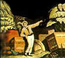
It would make a perfect place to hide a fleet. And so in 1784 the
legendary Admiral Horatio Nelson sailed
to Antigua and established Great Britain's most important Caribbean
base. Little did he know that over 200 years later the same unique
characteristics that attracted the Royal Navy would transform Antigua
and Barbuda in one of the Caribbean's premier tourist destinations. All the signs pointed towards Antigua.
The island had warm, steady winds, a complex coastline of
safe harbors, and a protective, nearly unbroken wall of coral reef.
It would make a perfect place to hide a fleet. And so in 1784 the
legendary Admiral Horatio Nelson sailed
to Antigua and established Great Britain's most important Caribbean
base. Little did he know that over 200 years later the same unique
characteristics that attracted the Royal Navy would transform Antigua
and Barbuda in one of the Caribbean's premier tourist destinations.
The signs are still there, they just point to
different things. The Trade Winds that once blew British men-of-war
safely into English Harbour now fuel
one of the world's foremost maritime events, Sailing
Week. The expansive, winding coastline that made Antigua difficult
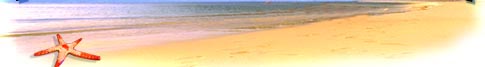
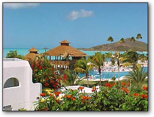
for outsiders to navigate is where today's trekkers encounter a
tremendous wealth of secluded, powdery soft beaches.
The coral reefs, once the bane of marauding enemy ships, now attract snorkelers
and scuba divers from all over the world. And the fascinating
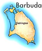
little island of Barbuda -- once a
scavenger's paradise because so many ships wrecked on its reefs
-- is now home to one of the region's most significant bird sanctuaries.
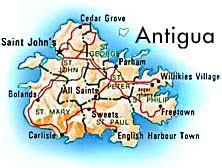
Location:
 Antigua
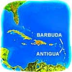
(pronounced An-tee'ga) and Barbuda are located in the middle
of the Leeward Islands in the Eastern Caribbean, roughly 17 degrees
north of the equator. To the south are the islands of Montserrat
and Guadaloupe, and to the north and west are Nevis, St. Kitts,
St. Barts, and St. Martin. Antigua
(pronounced An-tee'ga) and Barbuda are located in the middle
of the Leeward Islands in the Eastern Caribbean, roughly 17 degrees
north of the equator. To the south are the islands of Montserrat
and Guadaloupe, and to the north and west are Nevis, St. Kitts,
St. Barts, and St. Martin.
Size:
Antigua, the largest of the English-speaking
Leeward Islands, is about 14 miles long and 11 miles wide, encompassing
108 square miles. Its highest point is Boggy Peak (1319 ft.),
located in the southwestern corner of the island. Barbuda, a
flat coral island with an area of only 68 square miles, lies
approximately 30 miles due north. The nation also includes the
tiny (0.6 square mile) uninhabited island of Redonda, now a nature
preserve. The current population for the nation is approximately
68,000 and its capital is St. John's on
Antigua.
Climate:
Temperatures generally range from the mid-seventies
in the winter to the mid-eighties in the summer. Annual rainfall
averages only 45 inches, making it the sunniest of the Eastern
Caribbean Islands, and the northeast trade winds are nearly constant,
flagging only in September. Low humidity year-round.

This page, and all contents
of this Web site are Copyright (c) 1996-2010 by interKnowledge
Corp., New York, NY. All rights reserved. |
|
|